For our latest Flashback Friday post, we are revisiting one of our favorite waterfalls: Palouse Falls State Park in Eastern Washington.
As you drive through the rolling farmland of the Palouse, it is hard to imagine that somewhere in the middle of it is one of Washington state’s most majestic waterfalls.
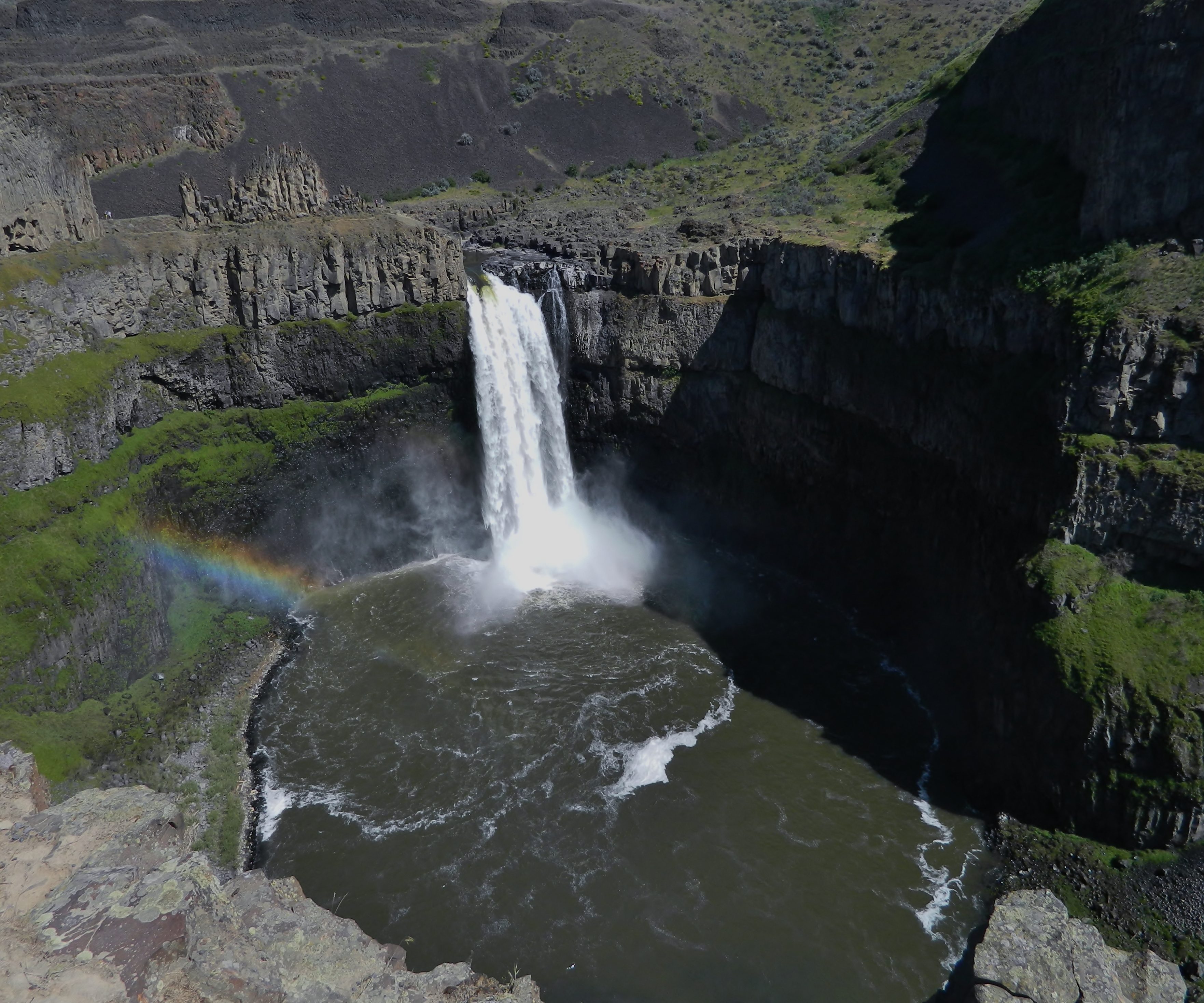
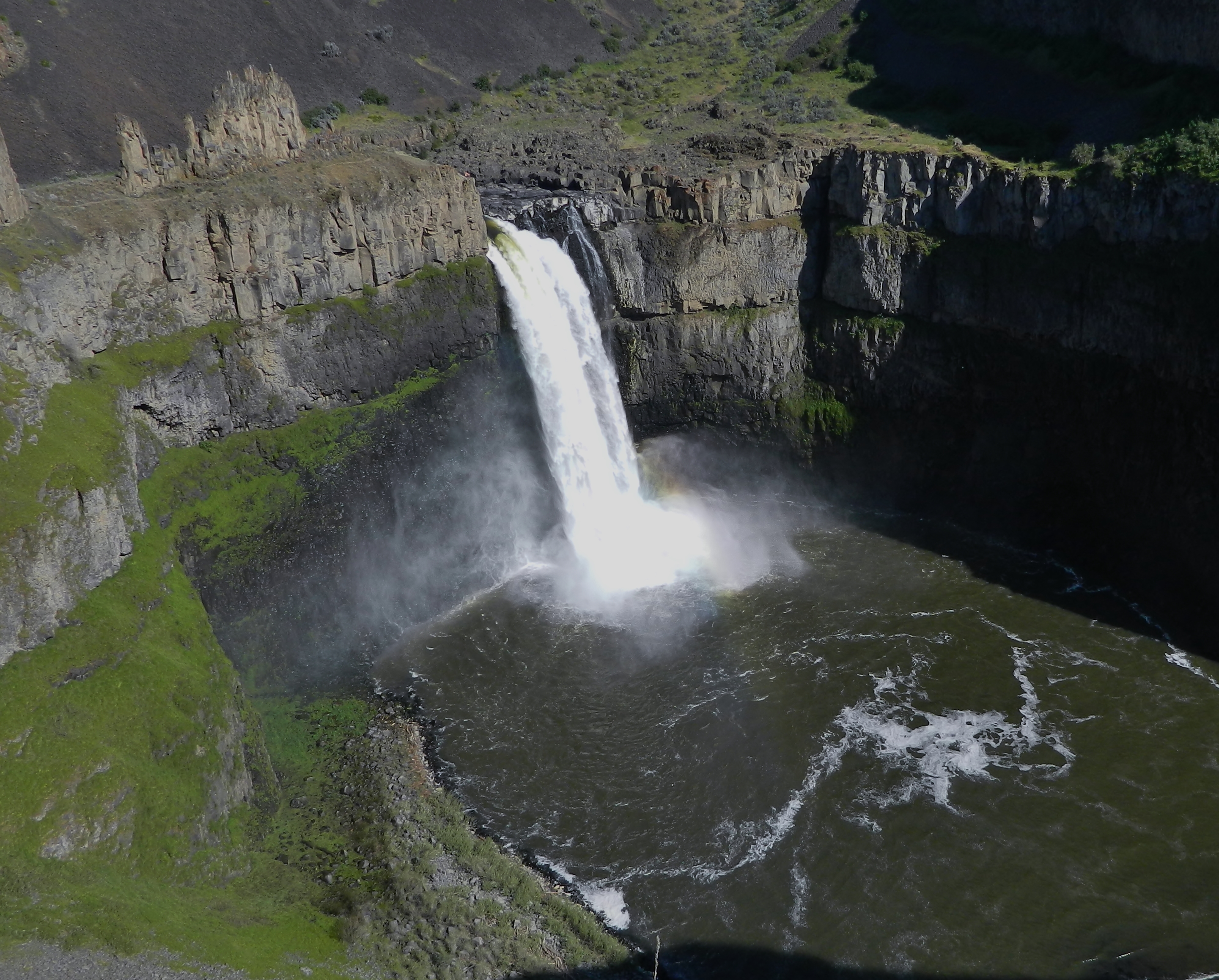
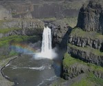
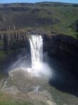
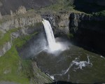
Palouse Falls stands at 198 feet tall, pouring the Palouse River into a majestic canyon that slices its way through the countryside, quickly joins the Snake River and eventually links with the mighty Columbia and soaring onward to the Pacific Ocean.

As you wind through the hills, eventually turning onto a small gravel road at the entrance to Palouse Falls State Park you hear the waterfall before you see it.
Visiting in the spring time is best, as the waterfall is roaring as the winter’s snow melts.

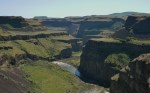
The park offers a path next to the fence line and up to a covered viewpoint which is downstream of the falls, giving you an excellent view into the mouth of the waterfall basin and an overhead view of the falls. You can also look further downstream and view a beautiful canyon, which is covered in green grass in the spring.
If you are feeling adventurous, head north from the parking lot on the gravel path, eventually cutting down a very steep hill with a long drop off to the side – best to carry your children at this point.
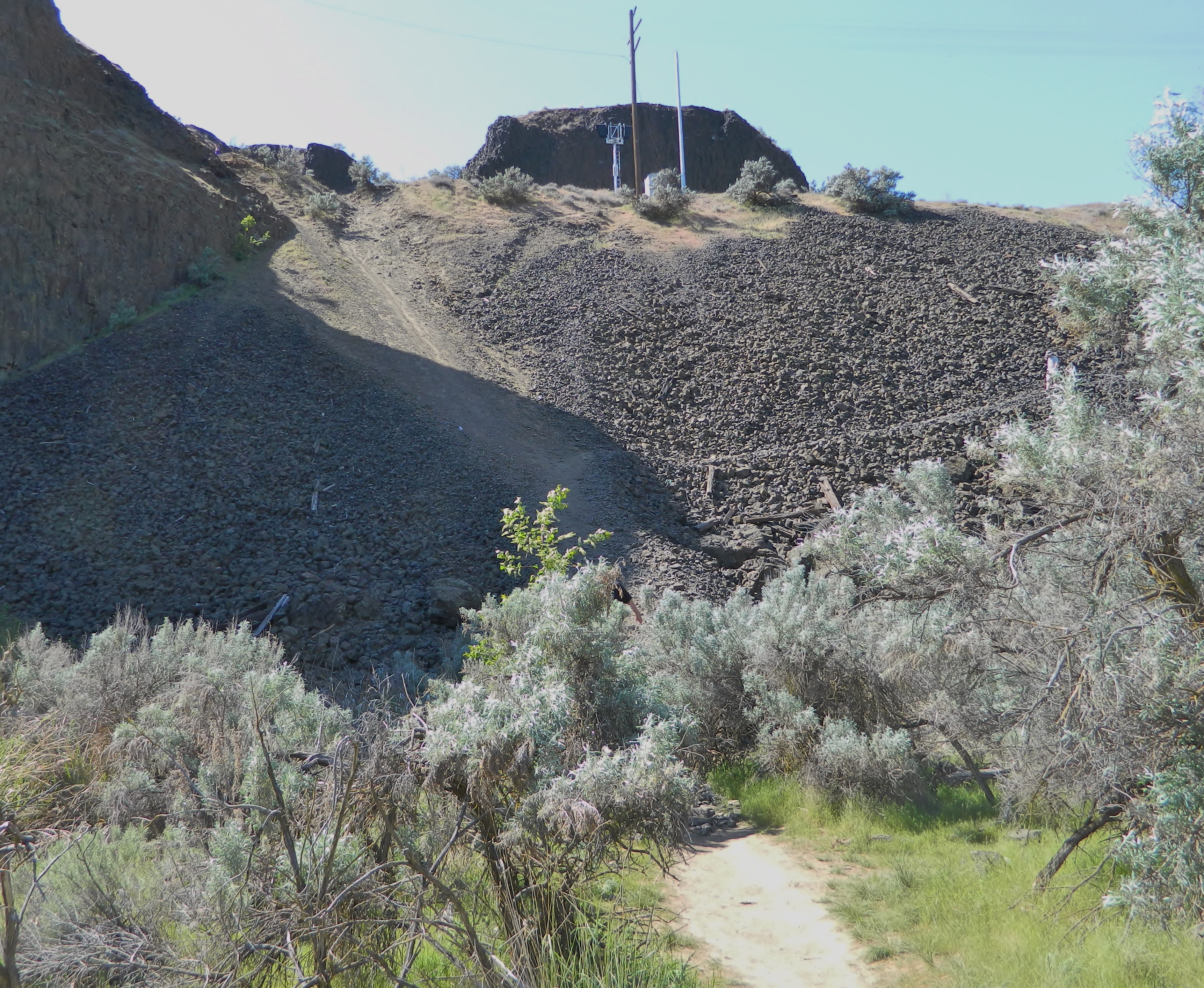
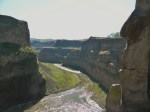
Make sure no trains are coming, and quickly walk less than a quarter mile down the tracks to a trail that switchbacks down the hillside, through the railroad rock to the valley below. When you reach the bottom, cut through the brush until you reach the Palouse River and see the upper Palouse Falls.

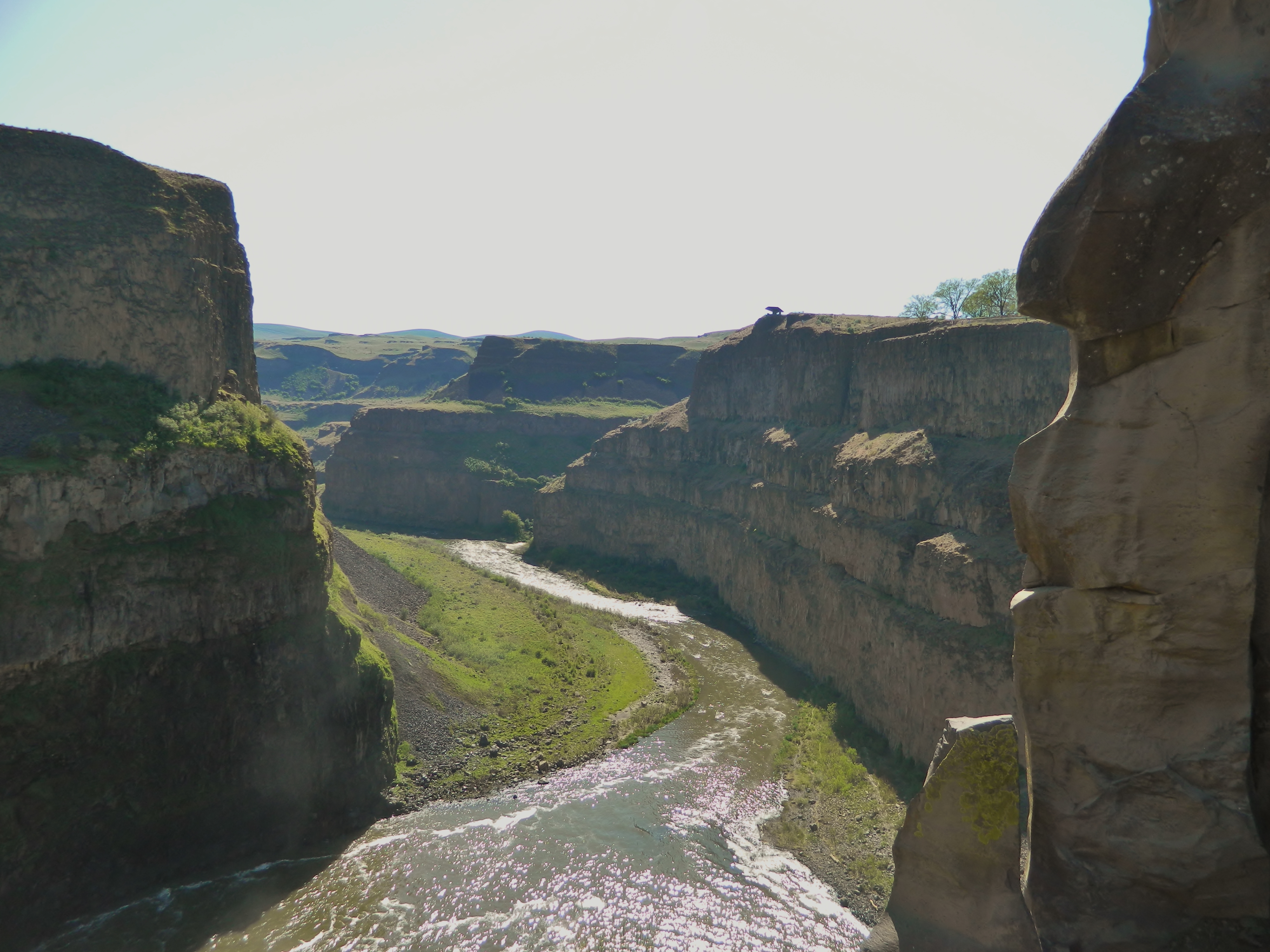
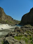
The giant rock face across the river from this vantage point is called The Castle, and it is extremely foreboding. You can hike upstream from here, though we never have. This is a nice place to wade and enjoy the spray off the upper falls and have a picnic.
Be very careful in the water at this point, though, as the current is very strong and the main falls are less than a mile away. You do not want to get caught in the main part of the river here.

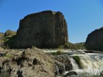
You can walk downstream at this point on a path above the river, eventually coming to a point near The Spires, which are a rocky outcropping above Palouse Falls. Be very careful as the area is not very wide and there is a huge dropoff into the falls basin below. The path continues past the Spires until it reaches the top of the falls. I’m not fond of heights, so I didn’t get very close, but my traveling companions did lean over and take a photo looking straight down the waterfall.
Be content with getting these photos and hike back from where you came. There are paths that go around the rim of the basin, but they are extremely hazardous and it is better to be alive than to fall to your death while visiting this magical place.
Also, be on the lookout for the Thinking Man rockface. I included a shot below. You can see him jutting out when you look downstream right before the Spires.
I have always wanted to go to the base of Palouse Falls, but have never had the time to do proper exploration. I’ve seen people down there fishing and wading before and I’ve found mention of a pathway in the dark corners of the internet, but it looks like it involves quite a bit of unsafe scurrying down a rocky hillside. And this area is know for rattlesnakes in the summer, so be forewarned.
In the end, this is the perfect place for the adventurous and the faint of heart. You can enjoy the scenery from the safety of the manicured park above, or hike to the top of the falls for some truly stunning views.
Either way, make time to visit Palouse Falls State Park in Eastern Washington.
– Craig Craker

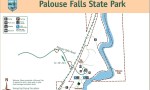
Location: Near Starbuck, Washington, off of highway 261; 100 miles east of Vantage and 80 miles northeast of the Tri-Cities.
When: Best visited in spring when winter snow is melting. Also has great photo opportunities in the winter, when the area around the falls freezes.
What: A 105-acre park with dramatic views of one of the state’s best waterfalls. 15 picnic tables, bathrooms, 11 tent sites and miles of hiking trails.
Fees: A Discover Pass is required. Either $10 per day, or $30 per year.
Kid-friendly: Yes, though there are big drop-offs, so keep them nearby.
More information: Palouse Falls State Park.
Photo gallery: Click on a picture below to bring up a slideshow.


Thanks for this informative post! Although I’m a born and raised Northwesterner, I’ve actually never been to Palouse Falls. So on my list.
LikeLiked by 1 person
Thanks Jill! We know you’ll love it.
LikeLike